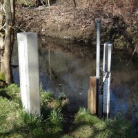
How much water flows from the mountains to streams and rivers? The United States Geological Survey maintains stream gauges in many places, including in Clackamas County. The USGS tracks this information through their National Water Information System.
The amount of water being moved through a stream or river is important in many ways. For watershed scientists, knowing how much water is being moved allows them to calculate how much nitrogen, phosphorus, sediment, and other things are being “exported” from the watershed. For fishery biologists, streamflow and the slope of the stream help control the kind of stream bottom that may be available to fish, and helps determine what kind of fish can live or reproduce in the stream.
As an example of how online data provided by the USGS can be used, Click link to view a real-time graph of streamflow in the Clackamas River near Oregon City. The graph was made through the USGS service at this link: https://waterdata.usgs.gov/or/nwis/uv. Another good resource is the USGS WaterWatch page that shows various conditions across the United States, including streamflow, flood and drought.


